Infrastructure monitoring in coastal US cities

Join the Move Solutions newsletter
Stay updated on product releases, news, and upcoming webinars.
Coastal infrastructure monitoring became a real US procurement concern in the years after the 2021 Surfside collapse and the federal repackaging of the National Bridge Inspection Standards. The scour-critical bridge requirements now codified at 23 CFR 650.313 trace back to the 1988 FHWA Technical Advisory, but the post-Surfside attention has pushed asset owners in Florida, Texas, and Louisiana to act on those requirements rather than file them.
The three hazard profiles, side by side
In each city, the structural hazard that dominates the monitoring case is different, so the sensor mix will differ as well.
In Miami the dominant hazard is slow vertical subsidence on coastal high-rises, made worse by saltwater table intrusion and a 14 to 26-inch sea-level rise projected by 2060 in the Southeast Florida Regional Climate Compact's unified projection. A 2024 study from the University of Miami's Rosenstiel School documented 35 high-rises along the Miami Beach to Sunny Isles stretch that are sinking measurably, some at rates of several millimeters per year. After Surfside, the regulatory and insurance pressure on that asset has grown. In the case of Miami, buildings are monitored for tilt and vertical displacement, because buildings can sink faster in one part of the foundations and this creates differential shear and bending stresses that damage the building's integrity.
Houston is a different problem entirely, since groundwater extraction from the 1940s to the mid-1970s pulled the land along the Houston Ship Channel between Baytown and Houston down by roughly two meters. That subsidence has slowed but never stopped, and it sits underneath an industrial corridor with heavy port traffic, hurricane scour exposure on Galveston Bay crossings, and refinery-adjacent vibration loads on structures that are already old. The signals are mixed, so engineers pair tilt for the subsidence mode with accelerometers for traffic and equipment-induced vibration, and dynamic displacement for the hurricane-event response on Bay-area spans.
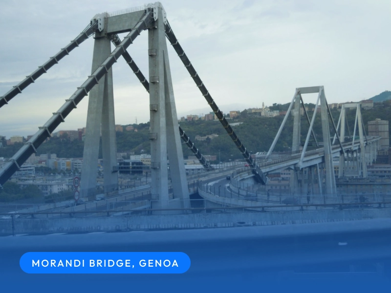
New Orleans monitors for soft sediment. The Hurricane and Storm Damage Risk Reduction System rebuilt after Katrina rests on alluvial soils that settle continuously, and the Mississippi crossings (Crescent City Connection carrying US-90 Business, Huey P. Long carrying US-90 and a two-track freight rail line) sit on scour-exposed piers. Storm surge events compress decades of structural response into a few hours. Tiltmeter chains, dynamic displacement on the river crossings, and selective vibration monitoring are the standard tools in New Orleans.
Three sensor mixes
For US coastal portfolios, a good monitoring system includes a wireless LoRaWAN network with battery-powered MEMS endpoints, gateway backhaul over 4G or LTE, and analysis in a data platform like MyMove.
For a Miami high-rise the starting set is usually four to eight tiltmeters distributed across the foundation perimeter and the upper floors, plus one or two DECK002-X dynamic displacement sensors on critical structural transitions.
For Houston, the typical first deployment on a Bay-area bridge is four to eight accelerometers at deck mid-span and quarter-spans, plus one tiltmeter per pier for the subsidence mode, and a DECKVBR-STD vibrometer if construction or industrial activity nearby could trip a DIN 4150-3 or UNI 9916-style PPV threshold. The accelerometer is the workhorse here because Bay-area bridges experience both daily traffic loading and episodic hurricane loading, and modal analysis catches both.
For New Orleans the mix is closer to Miami's on the levee assets and closer to Houston's on the Mississippi crossings. A levee section is instrumented with a chain of tiltmeters plus dynamic displacement at the toe; a Mississippi cable-stayed bridge is instrumented with accelerometers for modal monitoring and DDS for span-level response under traffic and storm surge.
Regulatory anchors and where SHM is (and is not) justified
US asset owners cite two anchors most often. The first is FHWA NBIS 23 CFR 650.313, which requires bridge owners to identify scour-critical bridges and prepare a Plan of Action to monitor them. The regulation does not mandate continuous SHM. It mandates a documented plan, and continuous instrumentation is one way to satisfy that obligation. In practice, a continuous tiltmeter-plus-DDS network can work as the cheapest defensible POA for a high-exposure river crossing, because the alternatives are a scheduled diver inspection or a permanent on-site engineer.
The second anchor is AASHTO LRFD's Extreme Event Limit States, which covers the design-side response to coastal storms and to vessel collision. AASHTO does not require operational monitoring either. It requires a design check. The monitoring case sits in the in-service phase, after construction is finished and the asset is loaded by traffic and weather.
Frequently Asked Questions
Can a MEMS wireless network survive salt air for the design life of a coastal bridge?
Yes, with two caveats. The enclosure has to be IP67 or better and the antenna design has to tolerate brine spray, both of which our coastal-class enclosures meet. The harder problem is gateway placement. Gateways that sit too close to a salt-spray zone corrode their RF connectors faster than the endpoints corrode their housings, and we have seen that mistake on more than one US deployment. Place the gateway uphill or upwind of the salt zone and the network behaves the same way it does inland.
When does Move recommend AGAINST continuous monitoring on a coastal asset?
When the asset has no scour-critical classification, no documented deterioration trend, no active construction or industrial vibration source nearby, and an inspection regime that the owner is actually following. In those cases the continuous network adds cost without catching anything the visual inspection cycle would miss.
Other articles


Subscribe to Updates
Stay informed about our latest innovations and insights.